On Saturday morning we awoke to the treat of sunny skies and a slightly warmer temperature, so we took advantage of the better weather and walked down to the waterfront.
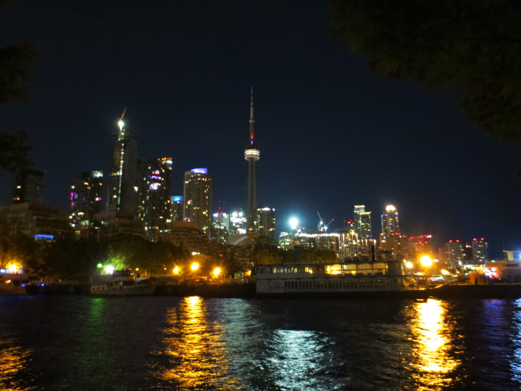
Many people who’ve never visited the city don’t realize we live on the edge of a big lake called Lake Ontario. It is 53 miles (85 kilometers) across and 193 miles (311 kilometers) wide and Toronto is located on the north western part of the lake. Canada wraps around the western part to Niagara Falls, where there is a border to the United States. So most of the southern edge of Lake Ontario runs along the state of New York, USA. These pictures of the water were taken looking south and the land you see out there are the Toronto Islands.
Although the city is right along this beautiful bit of water, it is very easy to forget that it is there in day-to-day city living, because it is kept separate by a stacked set of major roadways that someone had the bad idea to build right along the full length of the lake. To be fair, when it was first decided to put the major road there back in the late 1890s or so, Toronto was still a very small city and cars weren’t even invented yet.
But then in the mid 1950s city planners agreed to the building of the second layer of this road, a highway built above it, up on stilts. I would think that those people should have known better and given more consideration to the effect this would have on the Toronto of the future.
It is ugly, noisy and constantly full of traffic, cars and trucks coming to and from the suburbs or just passing by the city completely. To walk down to the water there is no avoiding walking underneath it. It’s quite dangerous and gross under there and most people wish it had never been built. For decades there has been talk about taking it down, but it is a major roadway and traffic would somehow have to find another way to get into or past the city.
This road is a hot topic in Toronto right now, as not only is the highway unsightly, it has come to a point that it is beginning to crumble and requires major repairs. The issue will take years and lots of money to take care of.
But enough with the complaining and back to the waterfront, because once you cross under the highway you find yourself in a very pretty place indeed. We walked along the stretch from Bathurst Street to Spadina, passing a marina, a small but very natural strip of parkland and an area that was once a parking lot but that has been transformed into a wetlands over the last decade, and which now supports a wide range of animals, insects, birds and fish.


[Edit : Thanks to a question by my online friend Annika over at All the Live Long Day, I’ve done a bit or research into this sculpture that is also a birdhouse, installed in the Spadina Quay Wetlands area of the harbour. Created by artist Anne Roberts and installed in 1999, it is a small scale replica of what Toronto’s buildings looked like in the 1900s. There is another picture of it and more information here and here.]


These swan and duck photos are tricksters, making things look a lot more springlike than they are. It is still very wintery here, with temperatures expected to drop back down to the minus double-digit range again by the middle of the week. The birds just happened to have found a small spot by the edge of the lake that wasn’t frozen.


Thanks for taking a look,
xo loulou