We got our first new car together this past year. To get around we have always relied on walking, public transportation or the use of a car-sharing service we are members of. Truth is, we didn’t really need a car. That’s not to say that we didn’t want one though. The freedom associated with having our own set of wheels was enticing, so last March we got our first car while we’ve been together. Well, I should say that Nick got our first car, a Mustang sports car. Anyway, it being brand new and the streets being grimy and salty in the winter months, we haven’t been using it much lately, preferring to keep it safe and sound (and pretty) in the garage. So when Nick went to start it recently, to take it for a spin on a gorgeous, remarkably warm day, it wouldn’t start. Lo and behold, the battery was dead. Little did we know that new cars use up their battery power pretty quickly and have to be driven every couple of weeks!
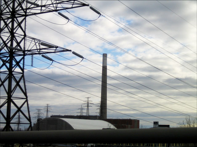
This has resulted in regular little drives around town to keep her going. Which brings me to these shots of an area that is called Toronto’s Port Lands. These pictures were taken from the moving car with the window rolled down (note I took the pictures while Nick was driving!). I just couldn’t resist this amazing looking sky.
The Portlands are a 5 kilometer area located at the mouth of the Don River, along the waterfront just to the east of the downtown core. Once an area of industry, the plants and factories have been shut since the 80s so not much goes on down there today (from what I understand, but I haven’t actually been down there myself and am unsure as to whether one can even go there or if it’s all fenced off).
It’s kind of a sad situation because, from what I understand the land is polluted from the industry that once went on there, but originally it had been a natural marshland and habitat of many birds and animals. But of course, way back when they began to use the land for industry, (we’re talking the mid 1800s), it was quite a way from what the eastern border of the city, and they had no idea at the time that eventually, as the city grew to the east, this land would be very close to the city centre. Throughout recent years however, there have been many plans put forward to revitalize this part of the city, one new proposal having come forward as recently as last fall.
This last photo was taken after we’d parked the car at an odd kind of brand new shopping mall in the middle of nowhere. While Nick went to the bank, I walked behind the mall to get this picture. I’m not sure what this place is though.
This is not to say that all of the waterfront to the east of the city is spoiled. I’m talking about a relatively small area and there are plenty of beautiful places to go along the water a little further east than this. In fact, there’s a very desirable neighbourhood out there called “The Beaches” and there are also many beautiful marinas and a spot where people swim in the summer, called Cherry Beach. A place where I have been to a lot as I used to go rollerblading there all the time, is called Leslie Street spit, which is a man-made spit with extends far out into the lake, offering stunning views of the city.
And now that we know we have to bring our little car out for ‘regular excercise’, I hope to get out to this part of the city I have never really explored due to being a west-end girl who was previously somewhat tethered without a car … until now!
Thank you very much for visiting my blog.
xo loulou


