Neighbourhood Exploration : Toronto’s Financial District

Hello and welcome! My previous post (aka : Part 1 of our really long walk!) was about an afternoon spent with my friend Meghan, where we checked out Toronto’s St. Lawrence / Old Town neighbourhood.
This is Part 2, as we continued walking, going westward along Front Street, and took a look at The Financial District, which spans roughly from Front Street on the south, up to Queen Street West, between Yonge Street and University Avenue.
Now, I understand that this might not sound like the most exciting part of the city to explore, but hopefully after seeing what we saw, you’ll agree that Toronto’s business affairs are conducted within a pretty spectacular looking forest of concrete and glass.
In this particular neighbourhood, fewer historic pre-1900 buildings are found when compared to the rest of the downtown core. That’s because a large swatch of the area burned to the ground during The Great Fire of 1904, when 118 buildings were totally destroyed in eight hours. (I discussed another “Great Fire” in the previous post, which occurred in Old Town in 1849, but as far as damage goes, this second one was the greater of the two, for sure.)
To give scale to the devastation, it caused the loss of 5,000 jobs in a city of 200,000 people at the time. Considering that it was mostly men who worked back then, and families were quite large, this would have meant that a high percentage of families lost their main source of income. To this day, it remains the largest fire ever to have occurred in Toronto. Thankfully it happened at night, so no one was injured. One man, John Croft, an explosive expert, died while clearing the ruins afterward, though.
So, that happened in 1904 and the first of the skyscrapers that currently make up the Financial District went up in the 60s, leaving about 50 years in between. I can find little information about what happened to the burned out landscape in the interim, except that The Royal York Hotel was built, opening in 1929, and the “new” Union Station opened in 1927 (it replaced the “old” Union Station that had been located to the west.)
On with our walk!

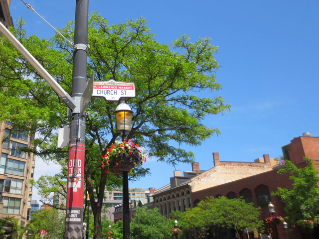
↑ Leaving Old Town and going westward along Front Street, here we are nearing Yonge Street and entering Toronto’s Financial District. You can see part of one of the old fashioned lamps that light the streets of Old town on the very right edge of the photo.
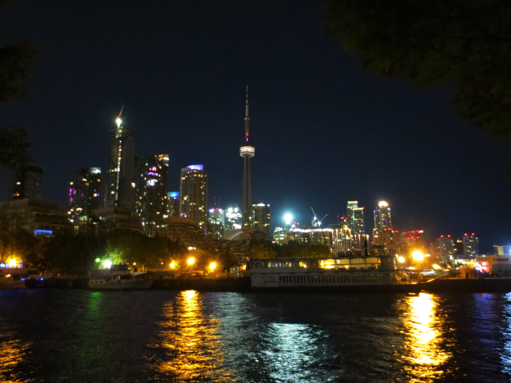
The Sony Centre for the Performing Arts is on the left and, of course, the ever-looming CN Tower is there in the centre. To the right of that is one of the towers that make up Brookfield Place (more on that further down). ↑

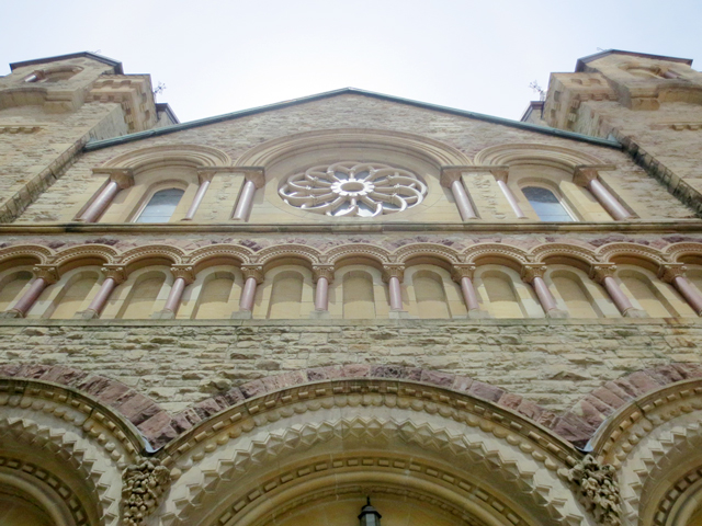
↑ This historic building, located on the north-west corner of Front and Yonge, was built for The Bank of Montreal in 1885. We’re lucky to still have it, as it was on the extreme edge of the area destroyed by the fire. Today it houses The Hockey Hall of Fame and is part of Brookfield Place. ↑

↑ Looking westward from Front and Yonge, on the left is The Dominion Public Building built for the Canadian Government between 1926 and 1935. It is located at the southern tip of The Financial Distrist, on land that was cleared after the fire destroyed what was originally there.
It was recently sold to a private developer so the area on which it sits is surely to change dramatically in the near future, as applications for zoning changes and condo development have been submitted. They’re not obligated to do so but I hope they choose to create one of those “old melds with new” buildings that have been going up around town (one seen here, for example). ↑


↑ At the southern edge of Brookfield Place, which is a 5.2 acre office complex that covers a large part of the area that was completely destroyed in the fire. So far, we’ve seen one of its towers and the building above, and next we’ll be turning right and entering the complex, where a beautiful surprise awaits. ↑
But first, some refreshment!

↑ Entering their courtyard where we stopped for a drink. (looking north) ↑

↑ Muv Box is a temporary “summertime only” open-air bar lounge operated by Marché Mövenpick (who also have a restaurant within Brookfield Place) This outdoor space will be there until September 6th, 2019. ↑


It was so comfortable and nice on that patio.
Onto the surprise, which is known as “the crystal cathedral of commerce”. Located amoungst the office towers of Brookfield Place, The Allen Lambert Galleria, was designed by renowned Spanish architect, sculptor and painter Santiago Calatrava Valls and was built in 1992. < I encourage you to drop over to his website (linked) and click the Projects tab to see all the stunning places he has created. This man has truly made today’s world a more beautiful place.


↑ As mentioned, Brookfield Place was built on the part of Toronto that burned to the ground in 1904. How then, is this place, called “The Heritage Building” from 1845, here, you might be wondering. Well, the facade was picked up, stone-by-stone, and moved from its original location, which was just beyond the border of the fire, on Wellington Street. Today, it’s a fully functioning office space, which is understandably marked as having “no vacancy”! ↑


From here, we walked westward through the galleria, coming out on Bay Street (just south of Wellington).

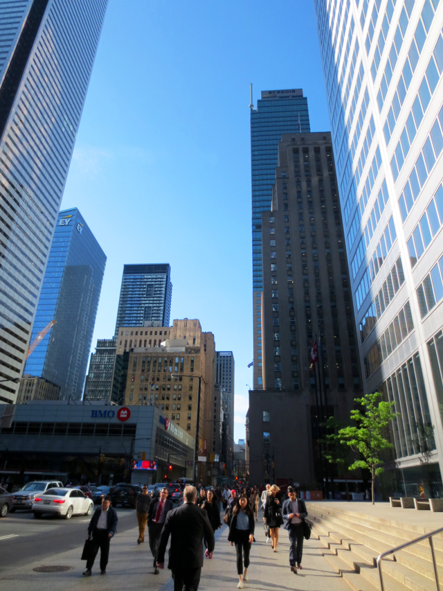
↑ Looking up (westward) from the exit on Bay Street. These buildings are all where the Great Fire of 1904 was. It began in a warehouse that was approximately where the centre white building stands.
The fire burned southward though, and we’re heading north, so everything you’ll see from here is in “no fire” zone. I didn’t take photos of all of them, but there’s a noticeable increase of pre-1900 buildings beyond, such as Osgoode Hall and The Old City Hall up on Queen Street West. (shown in this (old!) post, if you’d like to see.) ↑
From there we walked north on Bay Street.

↑ North of Wellington south of King Street West, on Bay Street, is one from 1937. It was originally home to Toronto’s Stock Exchange and is currently where you’ll find Canada’s Design Museum (I wrote about this interesting –and free! — museum in this post).
It’s attached to one of the towers that make up the Toronto Dominion Centre (more photos of those buildings in this post), making it one of those “old melds with new” constructions that I love so much! ↑
↑ We are approaching King Street West and Bay. ↑
There was another building that was around here between 1929 and 1972, that I wish was still there, because it was gorgeous. It was located at 80 King Street, near where the white building on the left in the photo above is. It was the Old Toronto Star Building, and was sadly only there for 43 years.
Described to have had a “front facade around the main entrance clad in granite, the entrance itself having a bronze screen. The first three floors of the building were clad in granite; the upper floors in limestone. On the third floor, the facade was wrapped in elaborate stonework in geometric and floral motifs, which also adorned the interior and the limestone piers at the crest of the building.” [Wikipedia, linked above],
It is said to have been the model for the Daily Planet Building in the original Superman comics. At 22 stories, it was quite tall at the time.
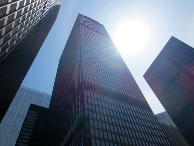
They demolished it to create what is still to this day, Canada’s tallest skyscraper with 72 stories. First Canadian Place, built in 1975.
(That is soon to be outdone by “The One” condo tower currently going up at Yonge and Bloor, which will have 85 floors and is expected to open in 2022. I previously posted this photo of that building site, if you’re interested.)

↑ Thankfully, there remains this other building that dates to the same time and has a similar look to the one that was destroyed. This is a photo of the western side of it. It’s located just east of King St West and Bay and I think it’s one of the prettiest buildings in the whole area. The Bank of Commerce Building opened in 1931.
At 34 stories, it was not only Canada’s tallest building at the time, but the tallest one in the entire British Empire.
(I must come back to take pictures of the front and maybe inside, if they’ll let me. They might not, though, for security reasons. I used to go inside regularly for work and the lobby is breathtaking, so if you’re ever walking by, try going in to see!)

↑ We turned left (westward) and walked along King Street West, from Bay Street. ↑
Meghan and I must have been discussing something especially interesting as we walked along King Street, because there’s a noted gap in my photos! However, I’ve photographed that stretch of King before and posted about it here, if you feel a need to see ;)

↑ Here we are, just outside The Financial District, entering The Entertainment District. The church seen in the reflection is interesting, and is discussed in detail in this previous post. ↑

↑ Looking westward along King Street West (towards the corner of Simcoe and King). The Entertainment District is beyond. ↑

↑ Roy Thompson Hall on the south west corner of King West and Simcoe. ↑

↑ I’ll leave you with my thanks for reading and a remnant from the basketball fever Toronto experienced earlier this summer, when The Raptors won the NBA Championship! ↑
xo loulou